Fishing Trip - August 29, 2006
Right after work today, I made a quick trip back tot the area we fished last saturday. I just kept thinking about that doormat that got away and had to go try once again. The tides were just right, the wind was blowing from the SW so the creek I was fishing was protected from the brunt of the 15 knot wind.
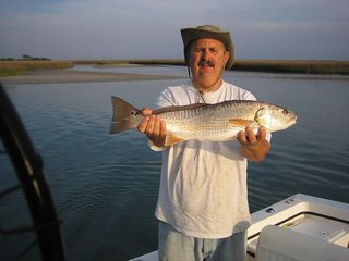
I anchored up and proceeded to cast in the same geenral area. After about an hour and no luck, I moved a hundred yards down the creek and promptly hooked-up on a 16 incher. Then a few moments later, another. I didn't find the doormat but hey, I'll take two keeper flatties anyday.
Enjoyed a beautiful sunset then headed to the hill.
posted by Mike @ 9:01 PM
2 comments
![]()
![]()

2 Comments:
We caught a 5 lb. Red behind Bald Head this weekend. Still trying to learn our way behind the island. Let me ask you if you know anything about a civil war rock wall in the bay between the beaches of Ft. Fisher and the ADM docks in the river? We apparantly hit it. We had just been to the ocean side and were heading back to Southport. We cut across the bay not knowing or seeing any problem areas. High tide, 8' of water doing about 25mph. BAM, hit something. Bent our prop and shaft. Soon thereafter we were pulled by Marine Patrol and we asked if they knew of anything. They said no. I looked on Google Earht satellite pictures and you can clearly see a straight line through the bay. We would have probably seen the structure if tide was lower. Nothing is marked as dangerous. Do you know anything about this wall?
Steve
said...
Steve - congratulations on the nice red! Sorry to ear about your prop though.
I have never fished or boated below Snow's cut so I really can't help you out with the waters there.
I do know that google is not realiable for checking on naviagble water. Some of the satellite maps are quite a bit out of date and if taken at high tide or on a stained water day, you can't see the shallow objects, also many of the names are incorrect or at least not what locals call them.
Have you looked on a marine chart of the area? Obstacles are marked with a small dashed circle and the letters OB, sometime the date first reported and depth are also notated.
Hope you get to fish for the reds again soon!
Post a Comment
<< Home